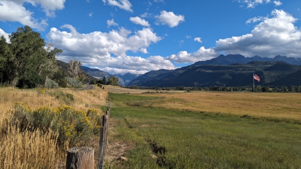
We got a pretty good night’s sleep. Minus a few trucks and motorcycles leaving camp, it was pretty quiet. We cleaned up, made some coffee, sat outside and watched the sun come up over the mountain peaks to the east. It was a perfectly clear sunny morning, the air was a little brisk, but we were up in the Rocky Mountains and 7,000 plus feet high. After breakfast we packed up our snacks and water, and headed south to Ouray for the day. Our goal was to walk the Ouray Perimeter Trail around the town. It’s a 20 minute drive from Ridgeway State Park and very pretty going along the Uncompahgre river and into the canyon that enters into Ouray.
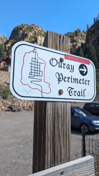
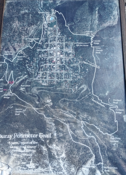
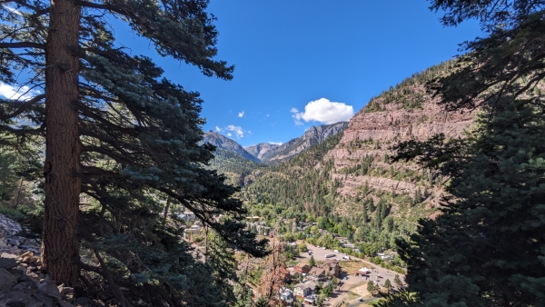
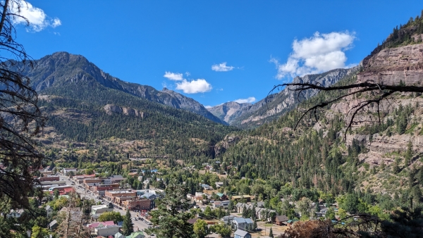
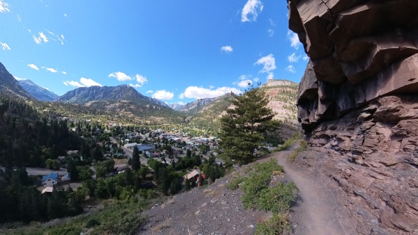
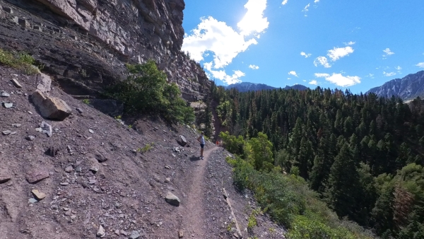
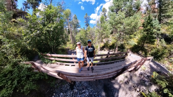
We started our hike at the Ouray Visitor’s Center, (trail map) in the same parking lot where the hot springs are located. From there we crossed the street and headed up the side of the mountain. We found out pretty quickly that this is not for the faint of heart. The trail switches back and forth up the side of the mountain and is very narrow in a lot of places. Narrow enough that if someone else is coming down, it’s best to stop and find a good spot to wait for them to pass. In some places it’s a rock wall on one side and a steep drop off on the other. As I was hiking I wondered how many people had fallen off this trail over the years, but at that moment, I really didn’t want to know. Beyond that it’s an awesome way to see the town from all different angles.
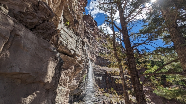
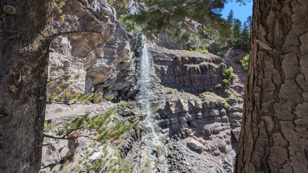
A short way down the trail you come to Cascade Falls, a big waterfall that comes down the canyon walls from high above. During this time of the year, there was not a lot of water coming down. I bet during the spring there is a lot more and might be cool to see. You can take a side trail that takes you down behind the falls but there were already people there so we passed on that. It seems kind of odd to be just out of town but feel like you are miles out into the wilderness. We were literally almost in someone’s backyard. We decided when we started the hike, if at any time we were done or worn out, we would cut back down into town and head back. There are many spots that you can do that, except towards the southern part of the trail, those are a little harder to get off and head back, but still possible.
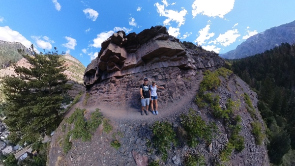
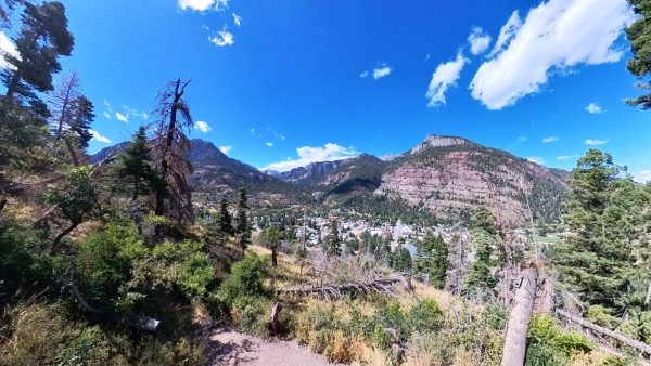
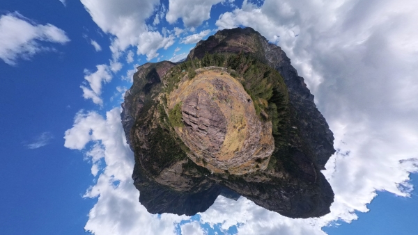
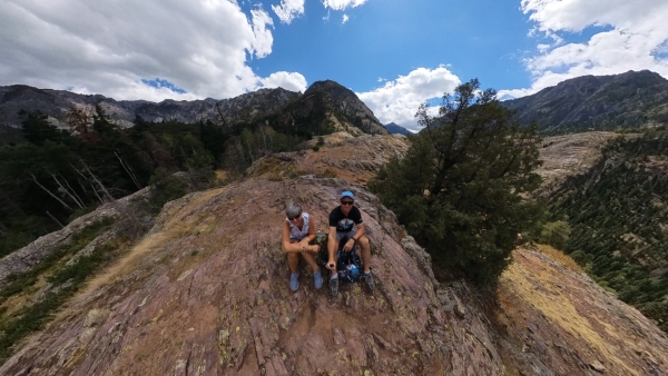
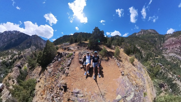
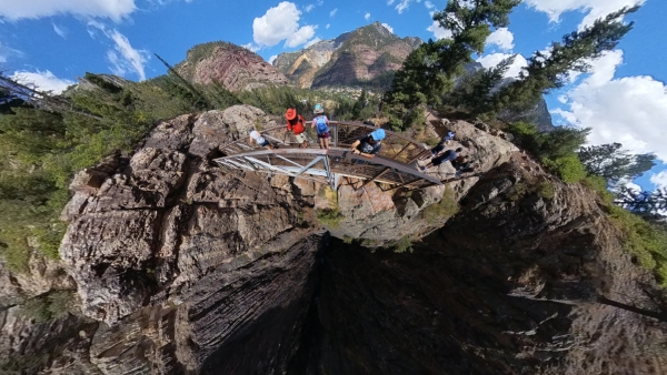
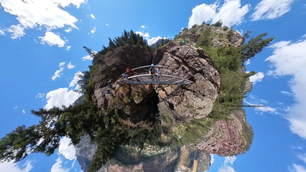
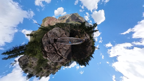
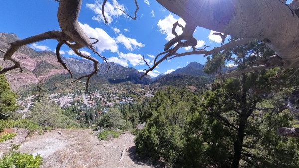
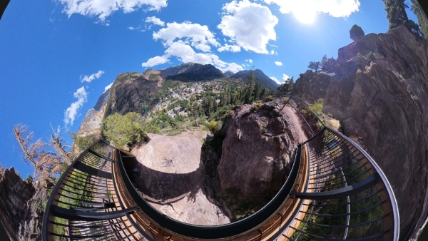
After about 2 hours, we made it to the southern part of the trail and to the highest point at 8500ft. We took a break to eat the snacks that we brought and just take in the beautiful view of the mountains around us. Spectacular view. Below is a 360 planet view that I created from a photo and a 360 view on Google that I posted.
360 Little Planet View
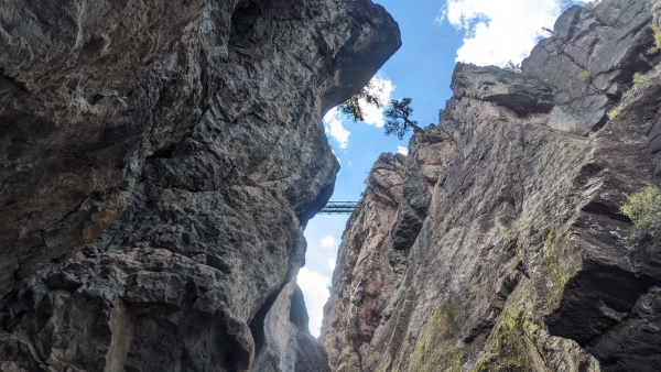
We started on the second half of our trek towards box canon and back to the Jeep. We decided to cut out the southern part of the parameter trail that takes you on the Ice Park Loop. We cut north on the Ice Park Loop that takes you over to the Ouray Ice Park Office. This cuts off about a mile to mile and a half of the trail. Ice Park Loop trail drops you at Camp Bird road, up the road you can catch the Perimeter Trail again. Once you cross the bridge here, if you look down in the canyon below, you may see some people climbing along the walls and adventuring the Ouray Via Ferrata. It looks like it might be a lot of fun. Also during the winter they spray water down in the canyon and people come from all around to ice climb. In late January they have the Annual Ouray Ice Festival & Competition. We have not been to this but it has been on our list of things that we would like to check out.
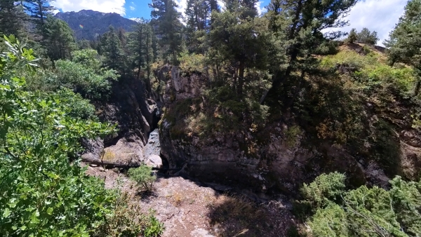
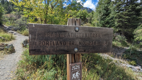
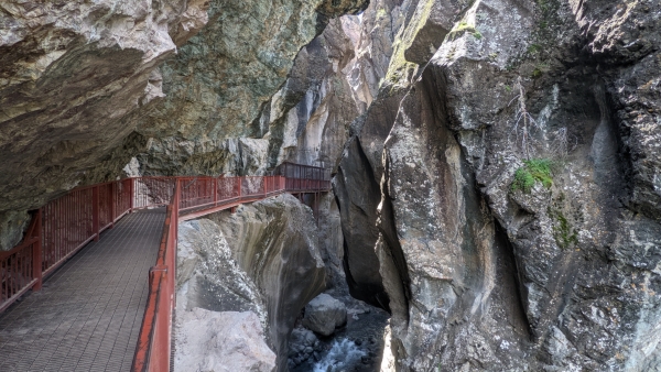
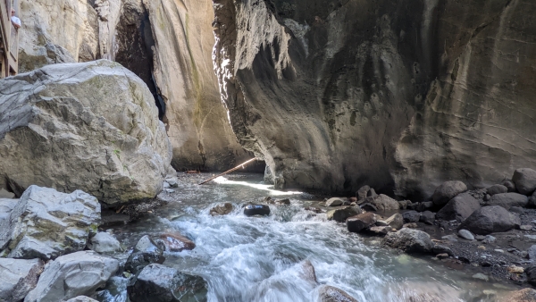
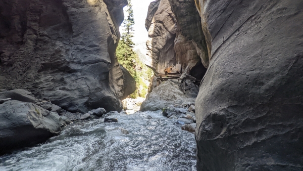
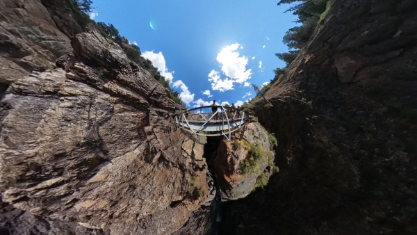
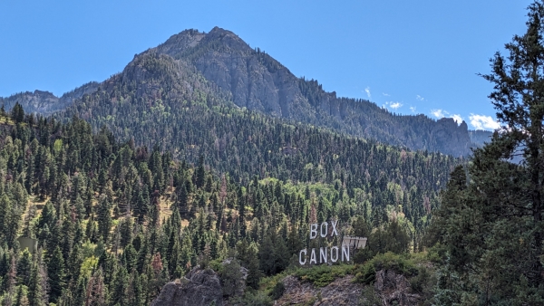
From the Ice Park area the trail continues across the road and takes you to another falls called Box Canon Falls. If you are not into torturing yourself with a hike around the town, you can park over at Box Canon Falls Park and walk up to the falls. There is a small fee if you want to hike down to the bottom of the falls that comes down through the rocks into an open cavern-like area below. We have hiked this part of the trail before, last year when we were in this area. It’s very pretty and would be really cool to see if there was a lot of water coming through there. There has been a fair amount of water both times we were there.
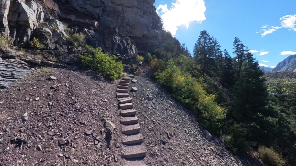
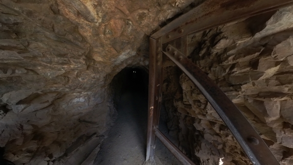
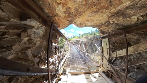
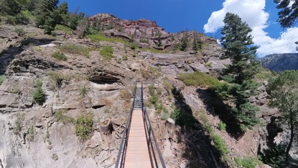
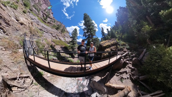
At the top of the falls is a steel bridge that takes you across the canyon and through an old tunnel carved out of the rocks. I am not sure what this tunnel was originally created for, but looks to have some old pipe to maybe transfer water through there. From there the trail heads down some steep steps with another great view of the town. Not too far past box canon the trail heads back up again which makes for a tiring trip after coming all this way, but at the top of the trail you get a great closeup view of the old box canon sign.
The trail heads up again some more, and at this part of the trail it was getting a little tiring but we were determined to finish this. From there it starts to head north across the side of the mountain. We were now on the west part of town, along the rock face and again there are some really narrow trails with big drops to the town below. There are parts that are slick shale and can be tricky in places but if you take it slow and watch your step it’s not too bad.
We made it back to the visitor center and sat in the Jeep, we had finished what we came to accomplish. We were tired but happy that we completed it. We sat at the back of the Jeep in the parking lot, ate the lunch that we brough and rested our bones. With the little short cut that we took on the southern part, it took us four hours to complete the loop. Not bad for someone who doesn’t get out and hike a lot. Overall I think we did about 4 to 5 miles, if you were to add the extra part that we skipped it’s closer to six. Maybe next time we are in this area will just do that part. We talked to an older guy on the trail and he said that the Ice Park Loop is a very pretty part of the trail and next time we should do that part too. To treat ourselves for making it all the way around the town, we walked over to Ouray Hot Springs and spent an hour or so soaking in the warm pools. It was great, the sun was passing behind the mountains, the deep blue sky and white puffy clouds made for an awesome backdrop to soak our achy muscles and tired feet.
We headed back towards camp but along the way made a quick drive through the small town of Ridgeway before heading back for the night. This is a small town that sits at the junction to Ouray and Telluride. They have a nice little park with a few restaurants and shops along the perimeter. It looks like they are fixing up some of the buildings to add more for all the tourists that pass through here year round.
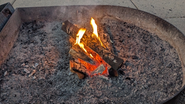
It was time for some dinner, sit by the campfire and watch what was left of the sun as it headed to bed too. It was another awesome day and we will be off again in the morning. We are headed to Telluride for more wandering and adventures.